Planning & Regulation Mar 17, 2026 13 min read
Do I Need a Flood Risk Assessment? The Complete UK Guide (2026)
Whether you are extending your home, building a new development, or converting a commercial property, one of the first questions your local planning authority will ask is: does this site need a Flood Risk Assessment? This guide explains when an FRA is required, what it must contain, and how to avoid common mistakes.
Whether you are extending your home, building a new development, or converting a commercial property, one of the first questions your local planning authority will ask is: does this site need a Flood Risk Assessment? The answer depends on where your site is, how large it is, and what you intend to build. Get it wrong and your planning application will be refused before it is even considered on its merits.
This guide explains when a Flood Risk Assessment is required under current planning policy, what it must contain, how much it costs, and how to avoid the most common mistakes that delay applications.
What Is a Flood Risk Assessment?
A Flood Risk Assessment (FRA) is a technical report that evaluates the flood risk to a proposed development and demonstrates how that risk will be managed over the lifetime of the development. It must also show that the development will not increase flood risk elsewhere -- a requirement that catches out many applicants who focus only on their own site without considering downstream impacts.
An FRA is not the same as checking the Environment Agency flood map and hoping for the best. It is a structured assessment that must address all sources of flooding -- rivers, the sea, surface water, groundwater, sewers, and reservoirs -- and account for climate change projections over the lifetime of the development.
The requirement for FRAs sits within the National Planning Policy Framework (NPPF), revised in December 2024, and the Planning Practice Guidance (PPG), updated in September 2025. Together, these set out a risk-based approach to development and flooding that every planning application must comply with.
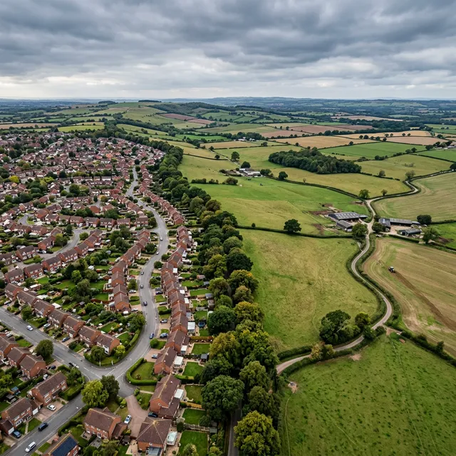
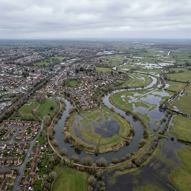
Understanding the Flood Zones
The Environment Agency classifies land in England into four flood zones based on the annual probability of flooding from rivers and the sea. These zones are the starting point for determining whether your site needs an FRA and what type of development is appropriate.
Flood Zone 1 -- Low Probability
Land with less than a 0.1% annual probability of flooding (less than 1 in 1,000 chance in any given year). This is the lowest-risk category. Most development is appropriate here, and an FRA is not required unless the site is 1 hectare or larger, or the site has been identified as having critical drainage problems, or the local authority's Strategic Flood Risk Assessment indicates increased risk during the development's lifetime.
Flood Zone 2 -- Medium Probability
Land with between a 0.1% and 1% annual probability of river flooding, or between 0.1% and 0.5% annual probability of sea flooding. A site-specific Flood Risk Assessment is required for all development in Flood Zone 2. The Sequential Test must be applied, and highly vulnerable uses (such as basement dwellings, caravans, and mobile homes intended for permanent residential use) will need to pass the Exception Test.
Flood Zone 3a -- High Probability
Land with a 1% or greater annual probability of river flooding, or a 0.5% or greater annual probability of sea flooding. An FRA is mandatory. The Sequential Test and, for more vulnerable and essential infrastructure uses, the Exception Test must both be passed. Highly vulnerable development should not be permitted in Flood Zone 3a.
Flood Zone 3b -- The Functional Floodplain
Land where water has to flow or be stored in times of flood, typically with a 5% or greater annual probability of flooding (1 in 20 chance in any given year). This is the most restrictive zone. Only water-compatible uses and essential infrastructure that has passed the Exception Test should be permitted. No residential development is appropriate in Flood Zone 3b.
You can check which flood zone your site falls in using the Environment Agency's Flood Map for Planning service at flood-map-for-planning.service.gov.uk. Since August 2025, this service includes a new map layer showing climate change projections for flood zones -- an important addition that affects the long-term risk assessment for your site.
When Do You Need a Flood Risk Assessment?
The triggers for requiring an FRA go beyond simply being in a higher flood zone. Under current guidance, you need a site-specific Flood Risk Assessment if your development meets any of the following criteria:
The site is in Flood Zone 2 or 3. All development -- including minor development and changes of use -- requires an FRA.
The site is in Flood Zone 1 and is 1 hectare or larger. Even in the lowest-risk zone, larger sites must assess flood risk because the development can alter drainage patterns and increase surface water runoff.
The site is in a Critical Drainage Area. These are areas where the Environment Agency has identified critical drainage problems. Formal designations currently apply primarily in Devon and Cornwall, but other authorities may identify similar constraints through their Strategic Flood Risk Assessments.
The site is at risk from surface water flooding. Following the December 2024 NPPF update, the Sequential Test must now consider all sources of flood risk. If your site is in Flood Zone 1 but shown to be at risk of surface water flooding, the Sequential Test may apply and an FRA may be required.
The site is within an area shown at increased risk in future. The Flood Map for Planning now shows climate change projections. If your site falls within the expanded flood zone when climate change allowances are applied, the Sequential Test applies even though the site may currently be in Flood Zone 1.
The development increases the vulnerability classification. If you are changing the use of a building to a more vulnerable category -- for example, converting a warehouse (less vulnerable) to flats (more vulnerable) -- and the site is exposed to flooding from any source, an FRA is required.
When You Do Not Need an FRA
Not every project triggers the requirement. You generally do not need a Flood Risk Assessment for:
• Development in Flood Zone 1 on sites smaller than 1 hectare, provided there are no other flood risk indicators (surface water risk, critical drainage problems, or strategic flood risk concerns).
• Householder extensions and small non-domestic extensions under 250 square metres, provided they are not in Flood Zone 2 or 3 and are not increasing the vulnerability classification. These may be covered by the Environment Agency's standing advice rather than requiring a bespoke FRA.
• Like-for-like replacements that do not change the use, footprint, or vulnerability classification of the existing building.
If you are in any doubt, check the Planning Portal's flood risk assessment guidance or consult your local planning authority before submitting your application. An application submitted without a required FRA will be refused -- it is a validation requirement, not something that can be conditioned.
The Sequential Test and Exception Test Explained
Two policy tests sit at the heart of the NPPF's approach to flood risk. Understanding them is essential if your site is in a higher flood zone.
The Sequential Test
The Sequential Test requires applicants to demonstrate that there are no reasonably available alternative sites at lower flood risk where the development could be located. The aim is to steer development towards the lowest-risk areas first.
Following the December 2024 NPPF revisions, paragraph 174 states that the Sequential Test must steer development away from areas at risk of flooding from "any source" -- not just rivers and the sea. Surface water, groundwater, and sewer flooding are now explicitly within scope.
However, paragraph 175 introduced a pragmatic exception. If a site-specific FRA demonstrates that no built development, access routes, or vulnerable elements would be located on any part of the site at risk of flooding from any source -- now or in the future -- the Sequential Test need not be applied. This helps sites where only a small portion falls within a flood risk area and the development can avoid it entirely.
The Sequential Test is not required where a site has been allocated in a local plan that already applied the test at the plan-making stage (paragraph 180), unless material flood risk information has changed since allocation.
Exemptions from the Sequential Test include householder extensions, minor non-domestic extensions under 250 square metres, and certain changes of use that do not increase the vulnerability of the development.
The Exception Test
If your development passes the Sequential Test (or is exempt from it) but proposes a vulnerable use in a higher flood zone, the Exception Test may also be required. It applies to:
• Highly vulnerable uses in Flood Zone 2
• More vulnerable uses in Flood Zone 3a
• Essential infrastructure in Flood Zones 3a or 3b
• More vulnerable uses in Flood Zone 3a
• Essential infrastructure in Flood Zones 3a or 3b
The Exception Test has two parts, and both must be satisfied:
1. Wider sustainability benefits. The development must provide wider sustainability benefits to the community that outweigh the flood risk -- housing delivery, economic regeneration, or multifunctional SuDS and nature-based solutions that deliver biodiversity and climate resilience alongside flood risk reduction.
2. Safe development. The development must be safe for its lifetime without increasing flood risk elsewhere, with safe access and egress maintained during a flood event.
Flood Risk Vulnerability Classifications
The NPPF classifies development by its vulnerability to flooding, and this classification determines which flood zones are appropriate and whether the Exception Test applies:
• Essential infrastructure (transport, utilities, wind turbines) -- appropriate in all zones, Exception Test required in 3a/3b.
• Highly vulnerable (basement dwellings, permanent residential caravans, hazardous substances installations) -- not appropriate in Flood Zone 3a or 3b.
• More vulnerable (dwellings, hotels, hospitals, residential institutions) -- Exception Test required in 3a, not appropriate in 3b.
• Less vulnerable (shops, offices, restaurants, general industry, storage) -- appropriate in Zones 1, 2, and 3a, not in 3b.
• Water-compatible (flood control infrastructure, water-based recreation, docks) -- appropriate in all zones.
A common mistake is assuming that because a site already has buildings on it, any new use will be acceptable. If you are converting a commercial building (less vulnerable) to residential flats (more vulnerable) in Flood Zone 3a, you will need to pass the Exception Test -- even though the building already exists.
What Must a Flood Risk Assessment Include?
A compliant FRA must address the following as a minimum:
• Site description and flood zone classification, confirmed using the Environment Agency's Flood Map for Planning.
• Assessment of all sources of flooding -- rivers, sea, surface water, groundwater, sewers, reservoirs, and artificial sources.
• Climate change allowances over the lifetime of the development. For residential schemes, this means a minimum 100-year assessment period. Current central allowances for peak river flow range from 20% to 50% depending on the river basin and time horizon.
• Impact on third parties -- demonstrating that the development will not increase flood risk elsewhere, typically through a sustainable drainage strategy.
• Mitigation measures -- site layout, floor level raising, flood-resilient construction, safe access and egress, flood warning plans, and SuDS.
• Sequential and Exception Test evidence, if applicable.
The Environment Agency published a standardised FRA template in March 2025, providing a structured framework for presenting this information. Using it -- or covering all of its required sections -- reduces the risk of your FRA being returned as inadequate.
Sustainable Drainage Systems (SuDS)
The NPPF now requires all development, not just major development, to incorporate sustainable drainage systems proportionate to the scale and nature of the scheme (paragraph 182 of the December 2024 NPPF). This is a significant change from the previous position where SuDS were only required for major development of 10 or more dwellings or sites of 0.5 hectares or more.
In addition, the new National Standards for Sustainable Drainage Systems, published in 2025, establish SuDS as the default approach for managing surface water in all new development. Designers are expected to show from concept stage how SuDS principles have been integrated into the scheme.
For practical purposes, this means even a single dwelling extension may need to demonstrate how surface water will be managed sustainably -- through permeable paving, rain gardens, soakaways, or other techniques appropriate to the scale of the project. Your FRA should address SuDS as part of the overall flood risk management strategy.
How Much Does a Flood Risk Assessment Cost?
The cost of a Flood Risk Assessment varies considerably depending on the complexity of the site, the flood zone, the size of the development, and the level of analysis required.
Basic desk-based FRAs for straightforward sites -- typically smaller residential schemes in Flood Zone 1 (where the trigger is site size rather than high flood risk) or low-complexity sites in Flood Zone 2 -- range from around £300 to £900.
Detailed site-specific FRAs for higher-risk sites or schemes in Flood Zones 3a and 3b -- where hydraulic modelling and complex mitigation design may be required -- can cost £1,200 to several thousand pounds. Major developments requiring bespoke hydraulic modelling can reach £5,000-£15,000 or more.
The key cost drivers are the level of modelling required, whether the Environment Agency has existing modelled data for your site, the complexity of the drainage strategy, and whether EA engagement is required as a statutory consultee.
For most residential planning applications and smaller commercial schemes, a desk-based FRA using existing Environment Agency data and published climate change allowances is sufficient. Site Intelligence's Flood Risk Assessment is delivered at a fixed price of £375 within 48 hours, covering flood zone analysis, all sources of flood risk, climate change allowances, Sequential Test evidence, SuDS strategy, and mitigation recommendations -- designed specifically for the planning applications that make up the vast majority of submissions.
Common Mistakes That Delay Planning Applications
These are the flood risk errors that most commonly cause delays or refusals:
Submitting without an FRA when one is required. This is a validation issue -- the application will not be registered, and you will lose weeks.
Ignoring surface water flood risk. Many applicants see Flood Zone 1 and assume no FRA is needed. But surface water flooding is now within scope of the Sequential Test. Check the EA's surface water maps as well as fluvial flood zones.
Failing to account for climate change. An FRA without current climate change allowances will be returned as inadequate.
Not addressing all sources of flooding. An FRA considering only river flooding when the site is also at risk from groundwater or surface water will be rejected.
Inadequate SuDS strategy. Since the 2024 NPPF changes and the 2025 National Standards for SuDS, every development must demonstrate sustainable drainage.
Overlooking safe access and egress. The planning authority must be satisfied that occupants can safely enter and leave the site during a flood event -- particularly for residential development and care homes.
Frequently Asked Questions
Do I need a Flood Risk Assessment for a house extension?
If your property is in Flood Zone 1 and the extension is a standard householder extension, you generally do not need a bespoke FRA. However, if your property is in Flood Zone 2 or 3, or if it is in Flood Zone 1 but at risk from surface water flooding, an FRA will be required. Extensions of 250 square metres or less may be covered by the Environment Agency's standing advice, which provides a simplified assessment route.
My site is in Flood Zone 1 -- do I still need an FRA?
Possibly. If your site is 1 hectare or larger, you need an FRA regardless of flood zone. You may also need one if the site is in a Critical Drainage Area, if the local authority's Strategic Flood Risk Assessment identifies increased risk, or if the Environment Agency's surface water flood maps show your site is at risk. Following the December 2024 NPPF update, surface water flood risk can trigger the Sequential Test even in Flood Zone 1.
What happens if I do not submit an FRA with my planning application?
If an FRA is required and you do not include one, your application will fail the validation check. The local planning authority will not register it, and you will need to resubmit with the FRA included. This typically adds 4-8 weeks to your timeline and may incur additional planning fees if the authority treats the resubmission as a new application.
Can I do a Flood Risk Assessment myself?
There is no legal requirement for an FRA to be prepared by a specific type of professional. However, the assessment must be technically competent, use current Environment Agency data and climate change allowances, and satisfy both the local planning authority and the Environment Agency. In practice, submitting an inadequate FRA causes more delay than submitting none at all, because the application may be registered but then stalled while the Environment Agency objects.
How long does a Flood Risk Assessment take?
A desk-based FRA for a straightforward site can be completed in 2-5 working days. More complex assessments requiring hydraulic modelling or site surveys can take 4-8 weeks. If existing modelled data is not available for your site, commissioning new modelling from the Environment Agency can add months.
What is the difference between a Flood Risk Assessment and a drainage strategy?
An FRA evaluates the risk of flooding to the site and how it will be managed. A drainage strategy sets out how surface water from the development will be collected, attenuated, and discharged without increasing flood risk elsewhere. In practice, most FRAs include a drainage strategy as an integral component, and since the 2025 National Standards for SuDS they are often submitted as a single document.
Understanding your site's flood risk is one of the first steps in any successful planning application. If you are unsure whether your project needs a Flood Risk Assessment, it is almost always better to commission one than to risk a refusal or delay. A properly prepared FRA does not just satisfy the planning authority -- it protects your investment by ensuring the development is safe and insurable for its lifetime.
Site Intelligence's Flood Risk Assessment report covers everything your planning application needs: flood zone classification, all sources of risk, climate change projections, Sequential Test evidence, SuDS strategy, and clear mitigation recommendations -- delivered in 48 hours at a fixed cost of £375. If you need to understand your site's flood risk before you submit, it is the fastest way to get the answer.
Related Report
Feasibility Intelligence
Planning-ready intelligence from From £895 — delivered within 48hrs
Ready to get started?
Complete desktop planning intelligence for any site in England. From £199.