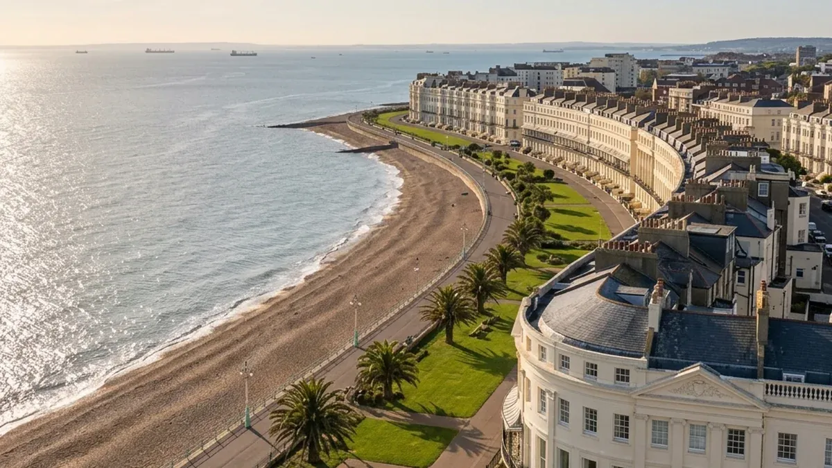
Planning in Brighton & Hove in 2026
Brighton & Hove planning constraints frequently turn an apparently viable site into an abortive bid. The unitary has no Green Belt, but the South Downs National Park defines its immediate northern edge, 34 conservation areas cover significant parts of the city (Regency Square, Old Town, Kemp Town, North Laine, Brunswick Town, Hove Seafront), there are approximately 3,400 listed buildings including the Royal Pavilion (Grade I), and coastal and surface water flood risk affects localised seafront and valley areas.
For a small developer or land buyer, the question is not whether Brighton has constraints. The question is whether the residual land value still works once heritage setting, flood evidence, affordable housing under Policy CP20, and SDNP fringe setting are priced into the offer. A site that looks like a clean infill at asking price can lose its margin to two specialist reports and a heritage objection before pre-app. The desktop Site Appraisal, from £295, reads any Brighton & Hove site against the City Plan Parts One and Two, the LPA's published 5YHLS position, the relevant designations, and the heritage, coastal, and viability constraint stack before you exchange, instruct architects, or submit pre-app. Start with a free site check — Request a Site Appraisal quote or See a sample report.
City Plan and 5YHLS position
Three pieces of plan-level context shape every Brighton & Hove application in 2026.
Local Plan status. Brighton & Hove City Plan Part One was adopted in March 2016. City Plan Part Two was adopted in October 2022. City Plan Review preparation is underway in 2026 to address growth needs to 2041, which means strategic allocations and policy direction are actively in flux.
Five-year housing land supply. The standard method requirement substantially exceeds recent delivery, constrained by the South Downs National Park boundary, urban density, and limited windfall capacity. Where the LPA cannot demonstrate a five-year supply the presumption is applied through NPPF policy S3(1), which routes the site by geography: policy S4 inside the settlement boundary, policy S5 outside it. A supply shortfall no longer switches a favourable balance on by itself; outside a settlement it bears on the evidenced unmet-need route at S5(1)(j), which carries its own tests. Designated heritage and flood risk now enter the balance through S4(2)(c) rather than through a footnote. Check the council's most recent published Authority Monitoring Report for the live position, since the figure moves and a tilted-balance argument depends on it.
Housing Delivery Test. The HDT result published by government is the relevant trigger for action plan, buffer, or presumption considerations. See GOV.UK Housing Delivery Test results and Brighton & Hove City Council Planning for the live HDT and 5YHLS positions before you rely on tilted balance in an offer or pre-app argument.
Constraints typical of Brighton & Hove development sites
| Constraint | Why it matters in Brighton & Hove | Developer risk before bidding |
|---|---|---|
| Conservation area | 34 conservation areas, design discipline and character appraisal compliance required | Density loss, materials uplift, heritage statement cost, longer determination |
| Listed building setting | 3,400+ listed buildings, Royal Pavilion (Grade I), NPPF policy HE5(1) setting analysis common | Heritage harm tests under NPPF policy HE6 can refuse or scale-back the scheme |
| South Downs National Park immediate northern edge | Setting impact on fringe sites, landscape and visual impact assessment expected | LVIA cost, height and massing limits, statutory consultation with SDNPA |
| Coastal and surface water flood risk | Sequential test under NPPF policy F5 can be engaged on seafront and London Road / Lewes Road valley sites | FRA cost, sequential test failure risk, climate change uplift on ground floor uses |
| Affordable housing 40% target (Policy CP20) | Viability evidence often required on schemes of 10+ units | Viability appraisal cost, GDV uplift required to absorb AH, Section 106 negotiation |
| Tilted balance route | Available where 5YHLS or HDT triggers it, but footnote 7 constraints often decide the outcome | Heritage and flood evidence can defeat a tilted-balance argument on a city-centre site |
| Tall-building townscape and heritage setting | City-centre and seafront schemes need heritage harm balancing under NPPF policy HE6 | Reduced storeys, design competition, longer pre-app, refusal risk |
Most Brighton & Hove sites we screen carry several of these in combination. The desktop pack checks the published policy, designation, flood, and heritage layers available from public and LPA sources against your specific red-line. For broader context, see our development land due diligence guide.
Hot policy issues in Brighton & Hove for 2026, by site type
- Seafront mixed-use. Coastal flood and climate change uplift, tall-building townscape policy, heritage setting of seafront listed terraces, ground-floor active use expectations.
- Conservation infill (Kemp Town, Brunswick, North Laine). Character appraisal compliance, listed building setting under NPPF policy HE5(1), density and rooflines, heritage harm balancing.
- Northern fringe adjacent to the SDNP. Landscape and visual impact, SDNPA as statutory consultee, height and massing constraints, dark skies on some edges.
- Brownfield railway and industrial land. Phase 1 desk study almost always triggered, contamination from historic gasworks and chemical uses, remediation cost in the appraisal.
- Small flatted schemes (10+ units). Affordable housing viability under Policy CP20, dual-aspect and amenity standards, cycle and refuse storage, neighbour daylight.
These themes drive bid pricing, scheme design, and the choice between conventional and tilted-balance planning routes.
Reports commonly triggered on Brighton & Hove sites
The Site Appraisal flags which of the following apply to your specific site.
- Heritage statement desktop. Triggered when the site is in or adjoins a conservation area, affects the setting of a listed building, or is within Royal Pavilion sightlines. SME developers should care because heritage harm can refuse the scheme or strip storeys before pre-app.
- Desktop flood risk assessment. Triggered when the site is in Flood Zone 2 or 3, has surface water flood mapping, or sits in coastal flood with climate change uplift. SME developers should care because the sequential test under NPPF policy F5 can defeat the scheme regardless of design quality. See GOV.UK flood risk check.
- Phase 1 desk study. Triggered on former gasworks at Hove Lagoon, railway sites, historic seafront industrial uses, and chemical works. SME developers should care because remediation cost can wipe the residual land value.
- Planning constraints report. Triggered when the site has multiple overlays (conservation, SDNP setting, flood, listed building setting). SME developers should care because the combined stack often determines route and cost.
- Site feasibility study. Triggered on schemes of 10+ units where affordable housing viability under Policy CP20 is in play. SME developers should care because the viability case has to support the offer.
For the broader report ecosystem, see what reports you need for planning permission.
Request a Site Appraisal quote for a Brighton & Hove site
For SME developers, land buyers, and architect-led teams working on seafront mixed-use, city-centre brownfield, Kemp Town or Brunswick conservation infill, airspace and upper-floor conversion, HMO and co-living, or northern fringe sites adjacent to the South Downs National Park, the right entry point is a Site Appraisal.
- Inputs. Red-line boundary, postcode, scheme intent.
- Turnaround. Confirmed before you pay.
- Deliverable. Desktop pack covering policy fit, designations, constraint stack, and recommended next reports.
- Price. From £295 (Site Appraisal), £995 (Feasibility Intelligence), £2,250 (Pre-Application Pack), tailored (Consultant Handover Pack).
From £295 to identify walk-away risks before you spend on design, legals, or option fees. £995 for the feasibility upgrade. £2,250 to walk into Brighton & Hove pre-app with the constraint stack already mapped. Useful for investor, lender, and JV partner reporting where the appraisal needs an evidenced constraint position.
Request a Site Appraisal quote or See a sample report.
Scope note
This page is a Brighton & Hove-specific desktop overview based on published Local Plan, 5YHLS and HDT data, with designation summaries from public-domain mapping. It is not a site-specific planning constraints report. The Site Appraisal reads the specific red-line against the LPA's adopted policies map and constraints overlay. The South Downs National Park Authority is the planning authority for sites within the SDNP boundary. Last reviewed 2026-05-06. See GOV.UK planning permission guidance.