Planning in Tandridge in 2026
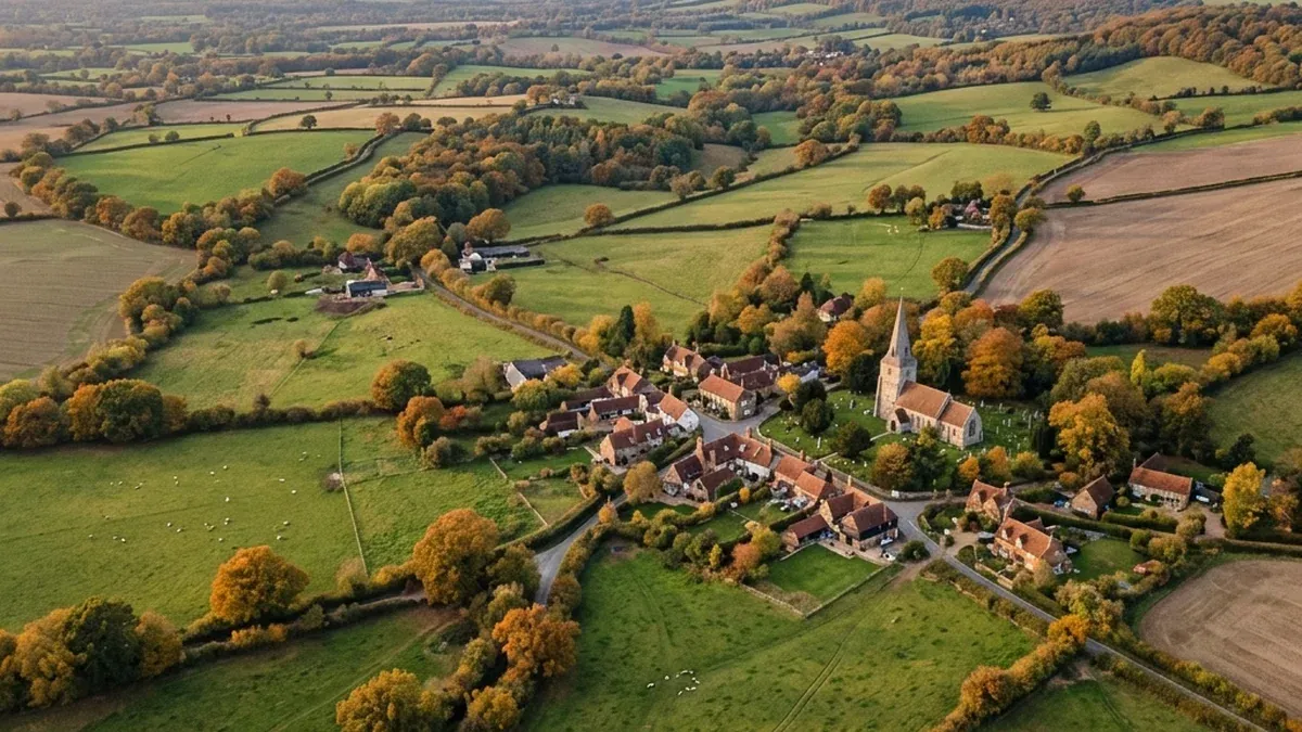
Tandridge is dominated by Metropolitan Green Belt, with the Surrey Hills National Landscape across roughly a third of the district, the North Downs ridge through the centre, the River Eden and Eden Brook corridor carrying Flood Zones 2 and 3 in the south-east, and over 20 conservation areas from Oxted to Lingfield to Godstone. Bidding into Tandridge without reading those constraints first is how SME developers lose deposits and abnormal-cost allowances on land they cannot deliver.
The desktop Site Appraisal from £199 reads your supplied red-line against the published Local Plan position, the council's latest five-year housing land supply, the Surrey Hills boundary, the Green Belt and grey belt position, and the heritage and SSSI position, in 48 hours. Order a Site Appraisal or See a sample report.
Local Plan and 5YHLS position
Current position summary.
- Adopted plan: parts of the Tandridge District Local Plan 2001 and the Local Plan: Part 2 Detailed Policies 2014 remain the development plan.
- Emerging plan: the Tandridge Local Plan 2033 examination was suspended in 2022 following Inspector concerns over Green Belt evidence and housing numbers. A revised plan-making programme is expected, and applicants should check the council's Local Development Scheme for the current timetable.
- Five-year housing land supply: Tandridge has historically struggled to demonstrate a five-year supply against a standard-method housing requirement constrained by 94% Green Belt cover. Confirm the latest published figure and base date in the council's most recent Authority Monitoring Report.
- Housing Delivery Test: recent published HDT measurements have been below 95%, engaging the action plan and 20% buffer requirements. Verify the current percentage on the published HDT results.
- What that means for paragraph 11(d): where 5YHLS is below five years and the most important policies are out of date, the tilted balance under NPPF paragraph 11(d) can engage, subject to the footnote constraints (Green Belt, designated heritage, SSSIs).
For the live policy position, the Site Appraisal checks the current Tandridge District Council Planning position at the date of order, alongside GOV.UK planning permission guidance.
Constraints typical of Tandridge development sites
| Constraint | Why it matters in Tandridge |
|---|---|
| Metropolitan Green Belt | Approximately 94% of the district. Very Special Circumstances or grey belt argument under NPPF paragraphs 154 to 155 typical on virtually all rural sites. |
| Surrey Hills National Landscape | Roughly 30% of the district. Additional landscape and visual impact assessment expected. Confirm boundary status with Surrey Hills Board. |
| Conservation area or listed building setting | Village and small-town infill commonly affected. NPPF paragraph 207 setting analysis required. |
| River Eden and Eden Brook flood zones | Sequential test under NPPF paragraph 174 in the south-east. |
| SSSIs (Mole Gap to Reigate Escarpment, Limpsfield Common, Hedgecourt) | Ecological survey scoping and mandatory 10% Biodiversity Net Gain. |
| Surrey CC highways consultee | Rural village sites with narrow lanes. Visibility splay constraints and access ransom risks common. |
| Tilted balance applications | Common given 5YHLS and HDT pressure, but Green Belt and heritage constraints often determine outcome. |
A typical Tandridge bid carries three to five of these constraints simultaneously, with Green Belt as the dominant theme. See what is included in our 48-hour desktop pack.
Hot policy issues in Tandridge for 2026
- Local Plan programme. Following the 2022 examination suspension, the council's plan-making programme is being revisited. Check the published Local Development Scheme for committee dates.
- Surrey Hills National Landscape boundary. A boundary variation review has been progressing. Confirm whether your site falls inside, on the edge, or within the setting of the designation, since landscape harm weighting changes with each.
- Grey belt tests in Green Belt villages. Edge-of-settlement land at Caterham, Oxted, Warlingham and Lingfield is being tested against NPPF paragraphs 154 to 155 and the golden rules at paragraph 156. See our grey belt site check guide.
- 5YHLS and HDT pressure. Tilted balance engagement on housing applications under NPPF paragraph 11(d), often defeated by Green Belt or heritage harm.
- Strategic infrastructure consultees. National Highways triggers on sites near the M25 and M23, and Surrey County Council highways on rural lane access.
Reports commonly triggered on Tandridge sites
| Report | Typical trigger | Buyer risk it de-risks | Indicative desktop cost |
|---|---|---|---|
| Heritage Statement (desktop) | Conservation area, listed building setting (NPPF paragraph 207) | Refusal on less than substantial harm under paragraphs 213 to 215 | From £499 |
| Desktop Flood Risk Assessment | Flood Zone 2 or 3, surface water risk on Wealden Clay | Sequential test failure under paragraph 174 | From £499 |
| BNG Screening | All major sites, SSSI proximity | 10% BNG shortfall, off-site units cost | From £399 |
| Planning Constraints Report | Green Belt, Surrey Hills, conservation overlap | Mispriced bid on undeliverable land | From £199 |
| Site Feasibility Study | VSC or grey belt argument needed | Yield, affordable, infrastructure viability | From £895 |
The Site Appraisal flags which of these apply on your specific red-line, with indicative cost. See what reports you need for planning permission.
Before you bid on a Tandridge site
For SME developers, land buyers, land agents preparing vendor packs, and funders running pre-acquisition due diligence, the commercial questions are concrete.
- Offer price and abnormals. Has your offer factored a Green Belt or grey belt VSC discount, or an abnormal-cost allowance for ecology, heritage and highways?
- Conditional contract or option agreement. On most rural Tandridge land, a conditional contract or option subject to planning is the right structure, not an unconditional offer.
- Walk-away triggers. Define them before you bid: SSSI buffer, listed building within setting, access ransom, Flood Zone 3a footprint over the developable area.
- GDV and unit yield sensitivity. Small-site viability in Tandridge villages turns on three to four unit-count steps. Test the lower end.
- Pre-app route. Tandridge pre-application advice carries weight where Local Plan policies are dated. A desktop pack ordered before pre-app sharpens the questions you ask.
The Site Appraisal exists to answer the bid or no-bid question in 48 hours, before solicitors are instructed. See our development land due diligence guide.
Order a Site Appraisal on a Tandridge site
- Inputs: red-line boundary, postcode or grid reference, brief scheme description.
- Turnaround: 48 hours.
- Deliverable: desktop Site Intelligence pack covering Local Plan position, 5YHLS, designations, constraints overlay, and report triggers.
- Price: £199 / £299 / £399 by complexity.
If the screening flags deeper work, the upgrade path is structured.
| Product | Price | When to order |
|---|---|---|
| Site Appraisal | From £199 | Bid or no-bid decision in 48 hours |
| Feasibility upgrade | From £895 | After screening, when yield and VSC argument need testing |
| Pre-application pack | From £1,995 | When walking into Tandridge pre-app with architect drawings |
What this desktop report does not replace
This is a desktop overview based on published Local Plan, 5YHLS and HDT data, with designation summaries from public-domain mapping. It does not replace specialist consultant reports such as a stamped Flood Risk Assessment, ecological surveys, or a heritage statement by a conservation specialist. Designation percentages are approximated and should be verified against the council's published constraints map for site-specific decisions. Last reviewed 2026-05-07.
Order a Site Appraisal from £199, or See a sample report.